
- 1:30 h
- 4.98 km
- 62 m
- 20 m
- 319 m
- 401 m
- 82 m
- Start: Parking lot Werdauer district Leubnitz-Forst
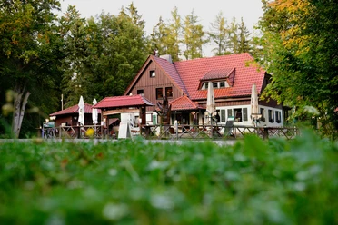
- Destination: Restaurant Weidmannsruh

Start
Destination
Pavements
- Unknown (2%)Gravel (77%)Trail (13%)Path (8%)
Best to visit
- suitableDepends on weather
Directions
- The hike starts at the parking lot in the Werdauer district of Leubnitz-Forst. Follow the edge of the forest to the Rohrteich pond to the "Alter Flößergraben". Continue along the bridle path to the Leubnitz wing, past the "Three Larches" and the "Turned Beech", along Benjes hedge to the Weidmannsruh restaurant. A detour to the Elferteich pond is also recommended. This pond was created as a water dam for the rafting
. After just under 1.5 hours, you will reach the Weidmannsruh restaurant. You can now walk back the same way or take the Bauernsteig trail to the water lily pond. From there, following Trünzinger Straße, you will return to the starting point of the hike in the Leubnitz-Forst district. Tour information
Stop at an Inn
Directions & Parking facilities
- ParkingParking lot Werdauer district Leubnitz-ForstPublic transportationBus
Additional information
- Tourismusregion Zwickau e. V.
Peniger Straße 10
08396 Waldenburg
Tel. 037608 27243
Fax 037608 27245
info@tourismus-zwickau.de
www.tourismus-zwickau.de Author
Ute Florl
Organization
Erlebnisheimat Erzgebirge
Author´s Tip / Recommendation of the author
- Sights
- "Rohrteich und Umgebung" natural monument
- Leubnitz outdoor pool
- guided tours with raftsman Ole possible
Refreshment stops
- Restaurant "Weidmannsruh"
- Restaurant "Zur Perlquelle"
- "Erdbeerschänke"