Mountain and valley - circular tour around Großolbersdorf


- 2:31 h
- 21.17 km
- 738 m
- 738 m
- 346 m
- 575 m
- 229 m
- Start: Parking lot at the town hall in Großolbersdorf
- Destination: Parking lot at the town hall in Großolbersdorf
Sporty for families with older children - approx. 20km
Starting point in Großolbersdorf: Parking lot at the town hall, hiking sign in front of the town hall on the left up the village to GH "Zur Silberstraße", turn left towards Scharfenstein, turn right after the sports field and follow the Plattenstraße (red markings), 2 km uphill to the junction at Lindenbaum with bench and signpost (wonderful views of the Erzgebirgskamm), turn left towards Hohndorf for 2 km until the junction with Schulweg, turn left 500 m downhill to Bäckerei Beyer, then turn left along Dorfstraße to the Mühlweg junction, Location of the Hohndorf hiking sign, 3 km through the Tischautal valley, past the Hohndorfer Mühle mill, Nesselfleck, follow the cycle path onto Helmgartenweg, before the office building turn left onto the Zschopautal cycle path for 6 km to Scharfenstein, Hopfgarten, Warmbad, cycle through the village of Warmbad, Cycle back 3 km on Warmbadstraße (marked red) to Großolbersdorf until the junction with Schulstaße, past the cemetery (visit Karl Stülpner's grave), visit the village museum, opposite the cemetery, to the town hall square (past the church). Starting point reached.

Waypoints
Good to know
Pavements
- Unknown (11%)Street (20%)Asphalt (14%)Gravel (21%)Trail (34%)
Best to visit
- suitableDepends on weather
Directions
Starting point in Großolbersdorf:
Parking lot at the town hall, hiking sign in front of the town hall left up the village to GH "Zur Silberstraße", left towards Scharfenstein, turn right after the sports field and follow the Plattenstraße (red markings), 2 km uphill to the junction at Lindenbaum with bench and signpost (wonderful views of the Erzgebirgskamm), turn left towards Hohndorf for 2 km until the junction with Schulweg, turn left 500 m downhill to Bäckerei Beyer, then turn left along Dorfstraße to the Mühlweg junction, Location of the Hohndorf hiking sign, 3 km through the Tischautal valley, past the Hohndorfer Mühle mill, Nesselfleck, follow the cycle path onto Helmgartenweg, before the office building turn left onto the Zschopautal cycle path for 6 km to Scharfenstein, Hopfgarten, Warmbad, cycle through the village of Warmbad, Cycle back 3 km on Warmbadstraße (marked red) to Großolbersdorf until the junction with Schulstaße, past the cemetery (visit Karl Stülpner's grave), visit the village museum, opposite the cemetery, to the town hall square (past the church). Starting point reached.
Tour information
Loop Road
Directions & Parking facilities
- ParkingRathausplatz / Am Rathaus (free of charge)Public transportationBus, train (Scharfenstein, 3 km away)
Additional information
Municipal administration Großolbersdorf, Am Rathaus 8, 09432 Großolbersdorf, Tel. 037369/1410, Fax. 037369/14120
Author
Michael Erler
Organization
Erlebnisheimat Erzgebirge
Author´s Tip / Recommendation of the author
RADschlag
Places of interest:
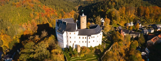
- Scharfenstein Castle
- Stülpnergrab, Schulstraße, cemetery
- village museum, April - October, Sat+Sun 14.00-17.00 and by appointment at the town hall Tel: 037369/1410
- Stülpnerberg, Warmbadstraße, Sun 9.00-12.00 (April-October) and by appointment at the town hall Tel: 037369/ 1410TO TABLE
Refreshment stops:
- GH "Zur Linde", at the town hall square, 037369/9323
- Pizzeria Ultimo, 037369/88545
- Sportheim, Scharfensteiner Sraße, 037369/9690
- GH Zur Erholung Hohndorf, 03725/ 22611
- Wurzelbachschänke
Download GPX file