Road cycling route Plauen - Pöhl


- 2:00 h
- 34.16 km
- 310 m
- 337 m
- 327 m
- 448 m
- 121 m
- Start: Lower Station Plauen
- Destination: Lower Station Plauen
The beginner's route starts at the Lower Station in Plauen but can be shortened to just under 20 kilometers if you start at Alt Jocketa. The route goes once around the Pöhl reservoir and offers great views of it.
The route is especially inviting on Sunday afternoons when the sky clears after a rainy weekend for a quick fitness session.

Waypoints
Good to know
Pavements
- Street (100%)
Best to visit
- suitableDepends on weather
Directions
- The start is at the Lower Station in Plauen. From here, you ride along smaller roads towards Möschwitz and out of the city. In Möschwitz, turn right towards Voigtsgrün. Then follow through the villages of Altensalz and Neuensalz, where you turn left onto the B173 towards Thoßfell. In the village of Thoßfell, again turn left to Gansgrün and then ride towards Helmsgrün. Via Neudörfel, you reach Alt Jocketa. The route continues over the dam and past the Gunzenberg campsite towards Möschwitz and back to Plauen at the Lower Station.
Tour information
Loop Road
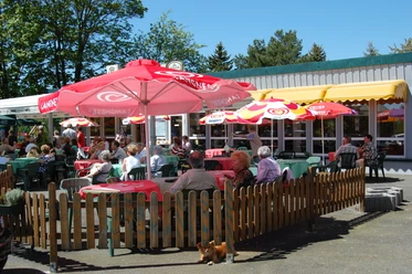
Stop at an Inn
Equipment
- This route can also be easily mastered by beginners while observing safety rules.
Directions & Parking facilities
- Getting therePlauen can be reached via the A72 or the A9 exit Schleiz, then the B282 and the B92.ParkingParking is available both at the Lower Station and around the Pöhl reservoir.Public transportation
Please use public transport information at 03744/19449 or at www.vvvogtland.de as well as in the Thuringian network the number 03661/706565.
Lower Station Plauen or Alt Jocketa Station
Additional information
- The ascent from 327 to 448 meters altitude can be managed well despite constant ups and downs.
Literature
More information can be found on the pages of the Vogtland Tourism Association at www.vogtland-tourismus.de or at 03744/188860 as well as at other tourist information offices along the route.
The brochure "Cycling Experience Vogtland" contains further routes.
Author
Saskia Prelec
Organization
Vogtland - Sinfonie der Natur
License (master data)
Saskia Prelec

Author´s Tip / Recommendation of the author
- Swimming in the area of the bathing beaches!
Safety guidelines
The road cycling route was tested with road cyclists. Nevertheless, personal fitness must be definitely considered and self-critically assessed by the cyclist.
Please pay attention to your safety, as you will be riding on public roads!
Map
Information about further trails and activities can be found on the activity pages of the Vogtland Tourism Association at www.vogtland-tourismus.de
Download GPX file