


- 4:40 h
- 16.17 km
- 469 m
- 469 m
- 602 m
- 884 m
- 282 m
- Start: Altenberg Spa Town - Tourist Information, Train Station
- Destination: Altenberg Spa Town - Tourist Information, Train Station
On this varied hike, discover various stops in Zinnwald that explore the climate of the Ore Mountains, offer fascinating insights into historical weather data, and showcase the beautiful landscape of the Eastern Ore Mountains. The highlight is the Kohlhaukuppe, where you can enjoy a leisurely break featuring the famous garlic specialties. An eventful loop hike for anyone who wants to combine nature, exercise, and regional delicacies.
The trail is not suitable for strollers or wheelchair users.






Pavements
- Street (18%)Asphalt (9%)Gravel (37%)Trail (28%)Path (8%)
Best to visit
- suitableDepends on weather
Directions
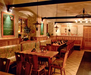
- You’ll start at the train station in Altenberg and walk to the Altenberg Adventure Mountain. This is where the Alte Zaunhäuser Weg trail begins; follow it until it intersects with Schneise 30. Now turn left onto this path and follow it to the Zinnwald Weather Station. You’ll pass the snow depth and ski day markers, which provide information on winter weather from previous years. At the end of the path, turn right and follow the road for a short distance. Then turn left onto Rosengrundweg and follow the signs along the Sommerweg to the Kohlhaukuppe. Once you reach the 786-meter-high mountain, you can stop for a break at the Bergbaude. It’s known for its garlic specialties. Then the descent to Geising begins along the forest trail; keep to the left here. Now follow the road briefly through Geising until you can turn left toward the ski lift. Passing it, the route continues to Oberes Vorwerk and back to Altenberg via Aschergraben.
Altenberg Train Station – Alter Zaunhäuser Weg – Schneise 30 - Hochmoorweg - Teplitzer Straße - Rosengrundweg - Sommerweg - Kohlhaukuppe - Waldweg - Malzbrache - Ski Lift - Oberes Vorwerk - Aschergraben - Bergstraße - Querweg - Altenberg Train Station
Tour information
Loop Road
Stop at an Inn
Summit
Tour with Dog
Equipment
- Sturdy shoes, rain gear, food, and possibly binoculars.
Directions & Parking facilities
- Getting there
Via BAB17—Bad Gottleuba exit—Lauenstein—Geising—Altenberg
Via B170 – Dresden – Dippoldiswalde – Altenberg / Teplice – Dubi – Zinnwald-Georgenfeld – Altenberg
ParkingYou can park your car in the parking lot (P2) by the elevator.Public transportationTrain: Dresden – Heidenau – Altenberg
Bus: Line 360 from Dresden Central Station, Line 398 from Teplice
Author
Tourismus Marketing Gesellschaft Sachsen mbH
Bautzner Straße 45/4701099 DresdenOrganization
Tourist-Information Altenberg
License (master data)
Tourist-Information Altenberg

Author´s Tip / Recommendation of the author
- A visit to the Kohlhaukuppe is highly recommended for all garlic lovers.
Safety guidelines
- Enjoy nature
- Let the forest creatures get a good night's sleep
- Protect plants and animals
- Keep emergency access routes clear
- Park in designated parking lots
- Don’t leave any trash behind
- Be considerate of others
- Prevent forest fires
- Be aware of forestry work
- Respect barriers
- Be careful and cautious
Map
- Hiking Around Oberbärenburg 1:25,000
Hiking and Biking Map of the Eastern Ore Mountains 1:33,000
Brochure on Terrain Therapy Trails
Available at the Altenberg Tourist Information Office and in the online store.