Winter hiking - Around Gornsdorf (Short route)


- 1:59 h
- 7.10 km
- 187 m
- 187 m
- 424 m
- 579 m
- 155 m
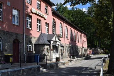
- Start: Parking lot - At the Volkshaus
- Destination: Parking lot - At the Volkshaus

Waypoints
Start
Destination
Good to know
Pavements
- Street (6%)Asphalt (31%)Gravel (16%)Trail (34%)Path (12%)
Best to visit
- suitableDepends on weather
Tour information
Loop Road
Directions & Parking facilities
- Getting thereGornsdorf is located between Chemnitz and Annaberg-Buchholz with immediate proximity to the A72 motorway and the Stollberg West exit. Federal highways B95 and B180 are located close to Gornsdorf. Please observe the signs on the federal highways for the exit to Gornsdorf.Parking3 parking spaces (free of charge)
Parking spaces are available on site. Please observe the signs.
Public transportationBus line 190 runs from Stollberg via Thalheim to Gornsdorf. Additional information
- Municipality of Gornsdorf, Hauptstraße 83, 09390 Gornsdorf, ki.rathaus@burkhardtsdorf.de
Author
Michael Erler
Organization
Greifensteinregion
Author´s Tip / Recommendation of the author
- AT THE TABLE
Dining options:- Volkshaus (Am Andreasberg 5)
- Lindenschänke (Hauptstraße 144)
- Silvio's Corner (Auerbacher Straße 1) Safety guidelines
- Attention - Notice! In winter (snow) this path is cleared only halfway. Please take this into account on your tour.
Download GPX file